

Locate Map Updates

Locate Map Updates

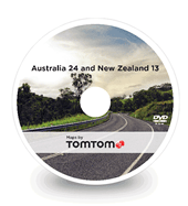
DENSO Navigation DVD (Complete Kit Version Aus24/NZ13) Australian Customers

Suitable for:
  • S-Type – All Models
  • X- Type – All Models
  • XJ – 2003 – 2009

Price:

$195.00

Incl. GST (Aust. only) plus shipping
Excludes delivery charges.

Available and ready to be shipped


AUSTRALIA 24 & NEW ZEALAND 13
Version Number Length of Road Covered
Version 24/13 TomTom 1,509,759 km
Version 23/12 TomTom 1,459,541 km
Version 22/11 TomTom 1,329,150 km
Version 21/10 Whereis® Maps 1,322,187 km
Version 20/9 Whereis® Maps 1,318,325 km
Version 19/8 Whereis® Maps 1,303,570 km
Version 18/7 Whereis® Maps 1,290,817 km
Version 17/6 Whereis® Maps 1,285,021 km

The TomTom Navigation Map Data provides a detailed digital road map guidance database for use in your vehicle navigation system. Australia 24 & New Zealand 13 is the latest database release, for more detail please see below:

VICTORIA MAP DATA FEATURES

Major New Roads:

  • Sneydes Road – Princes Freeway diamond interchange upgrade and dual carriageway addition
  • Burke Road – Glen Iris level crossing removal
  • Mountain Highway – Bayswater level crossing removal
  • Dingley Bypass – Added between Warrigal Road to Westall Road
  • Western Highway – Duplication between Beaufort and Buangor with three new bridges
  • Princes Highway East – Duplication from Traralgon to Sale
  • Princes Highway East – Duplication from Wurruk to Sale

TASMANIA MAP DATA FEATURES

No new changes.

SOUTH AUSTRALIA MAP DATA FEATURES

Major New Roads:

  • Onkaparinga Valley Road and Woodside Road – Roundabout added and dual carriageway extended
  • Main South Road upgrade – New geometry between Old Coach Road to Malpas Road
  • Safety upgrade on Augusta Highway, Mambray Creek – Realignment of Spencer Road intersection
  • South Road Superway – Stage 2: 4.8km non-stop corridor and 2.8km elevated roadway

NEW SOUTH WALES MAP DATA FEATURES

Major New Roads:

  • Pacific Highway upgrade near Sancrox – 3 new roundabouts
  • Werrington Arterial Road interchange – Creation of interchange with M4
  • WestConnex M5 near King Georges Road – Interchange upgrade
  • Richmond Road upgrade, Stage 2 – Dual carriageway with 4 lanes
  • WestConnex M4 – Parramatta to Haberfield Stage 1: 4 lanes in both directions
  • Beecroft Road and Carlingford Road intersection upgrade – Right turn lane addition
  • Pacific Highway upgrade – Nambucca Heads to Urunga
  • Pacific Highway upgrade – Tintenbar to Ewingsdale
  • Tulladunna Bridge replacement over Namoi River on Kamilaroi Highway
  • Princes Highway – 15km upgrade at Gerringong
  • Camden Valley Way – Stage 3 upgrade Bringelly Road to Ingleburn Road
  • Cumberland Highway upgrade – Right turn bays and Wetherill Street expansion to 4 lanes
  • Seventh Street extension, Mascot – Extended to Qantas Drive
  • James Ruse Drive – Intersection upgrade at Grand Avenue and Hassal Street, Rosehill
  • Hunter Expressway – Addition between F3 (M1 at Seahampton) to Branxton
  • M5 corridor expansion – South West Motorway widening Camden Valley Way to King Georges Road

QUEENSLAND MAP DATA FEATURES

Major New Roads:

  • Bruce Highway from Cooroy to Curra – Section A, Cooroy southern interchange to Sankeys Road
  • Steve Irwin Way and Bowen Road – Intersection upgrade
  • Mt Lindesay Highway – Turning lanes addition
  • Steve Irwin Way and Reed Street, Glass House Mountains – Intersection and dual carriageway upgrade
  • Olsen Avenue – Widening and lane upgrade
  • Pacific Motorway – Coomera exit 54 interchange upgrade with new dual carriageway and overpass

NORTHERN TERRITORY MAP DATA FEATURES

Major New Roads:

  • Roystonea Avenue and Palmerston Road upgrades – New lanes and widening
  • Temple Terrace and Roystone Avenue intersection upgrade, Yarrawonga
  • Tiger Brennan Drive – Duplication from Woolner Road to Berrimah Road

WESTERN AUSTRALIA MAP DATA FEATURES

Major New Roads:

  • Great Eastern Highway – Intersection and Central Avenue and Dunreath Drive connection upgrades
  • Perth Freight Link – Roe Highway upgrade from Tonkin Highway to Orrong Road
  • Graham Farmer Freeway and East Parade – Intersection upgrade with new geometry
  • Tonkin Highway – Abernethy Road on-ramp and grade separated interchanges at Dunreath Drive and Leach Highway
  • Kwinana Freeway southbound – Widening Stage 1: Roe Highway to Armadale Road
  • Kwinana Freeway southbound – Widening Stage 2: Armadale Road to Russell Road

NEW ZEALAND SOUTH ISLAND MAP DATA FEATURES

Major New Roads:

  • SH1 Russley Road and George Bellew Road – Intersection upgrade
  • SH1 at Russley Road – Over-bridge addition and intersection realignment
  • SH1 at Johns Road – Roundabout addition at Clearwater

NEW ZEALAND NORTH ISLAND MAP DATA FEATURES

Major New Roads:

  • SH1 at Ellerslie – Lane widening project
  • SH3 Rangitikei Street and Tremaine Avenue – Intersection improvement and widening
  • SH1 at Brynderwyn Hills – Realignment and conversion to dual carriageway
  • SH3 at Normanby – Bridge construction and realignment
  • SH1 at Northland – Akerama realignment with straightening and widening
  • SH1 at Rangiriri – New geometry between South Auckland and Cambridge